Service Details
Technical Core
- Borehole Drilling
- Soil Mechanics Testing
- Rock Mass Analysis
- Groundwater Mapping
- Topographic Survey
Exploration Solutions
- Drilling
- Investigation
- Subsurface
- Geotechnical
Project Support
- Environmental Impact Studies
- Technical Compliance Checks
- Site Feasibility Reporting
- Resource Management Plans
- On-Site Safety Monitoring
- Laboratory Data Verification
- +1-(314) 892-2600
- Onlinecourse@mail.com
- 7573 Ohio Street Moses Lake, WA 98837
Technical Precision
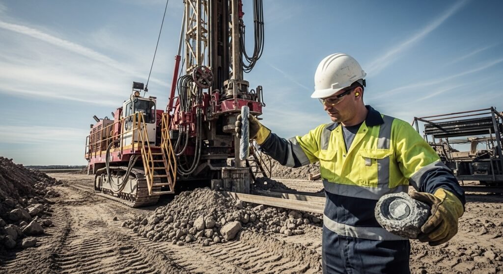
Geotechnical Site Investigations & Foundation Engineering
We provide high-precision soil and rock analysis to ensure the safety and stability of your construction projects. Using advanced drilling rigs and sensors, Advanced Geo Services Pvt Ltd delivers the data you need for bridges, dams, and high-rise buildings.
Hydrological & Mineral Exploration
Our team specializes in finding water and mineral resources through deep-earth resistivity surveys. We map the subsurface to give you a clear picture of what's beneath the ground before you start digging.

Our Technical Expertise & Process
We follow a rigorous technical framework to ensure the highest standards of data accuracy and site safety. Our advisory team guides you through every phase of the geological investigation, providing actionable insights for your project’s success.
Geotechnical SiteERT (Electrical Resistivity Tomography) Analysis
High-precision electrical resistivity surveys to map subsurface lithology and identify groundwater potential zones.
Seismic Refraction & Reflection
Utilizing seismic waves to determine rock depth, elastic properties, and fault line identification for structural safety.
Geotechnical Investigation
Detailed soil testing, borehole logging, and rock mass characterization to ensure a solid foundation for any construction.
GIS & Remote Sensing
Advanced spatial data analysis and digital mapping services for terrain evaluation and environmental planning.
Mineral Resource Exploration
Systematic geological mapping and core sampling to discover, evaluate, and quantify mineral deposits and natural resources.
Hydrogeological Studies
Specialized underground water modeling and aquifer testing to ensure sustainable water resource management.